
The Life and Times of Hubert Brooks M.C. C.D.
A Canadian Hero

 |
|
 |
It was not until the summer of 1916 that Hubert and sons Alfred and Aimé formally filled out HOMESTEAD applications for properties south of Old Bluesky.
(See following SECTIONS for replications of HOMESTEAD applications.)
For the homestead they acquired ¼ section of land (approximately 160 acres) for a $10.00 fee. Alfred and
Amié were financed in this venture by their father Hubert.
(The terms under the Dominion Lands Act, the federal government's plan for settling the North-West, was that the homesteader gained (final)
title to the quarter section if and only if after three years he had cultivated 30 acres and had built a house on the land.)
The Brooks boys homesteads were set up at the juncture of the Little Burnt and Peace Rivers, about 12 miles south of (Old) Bluesky whereas father Hubert Brooks had his homestead a few miles further north adjacent to the Old Burnt River. The area had rich brown furrows of sod and plentifull wild berries - especially sweet wild strawberries.
|
|

|
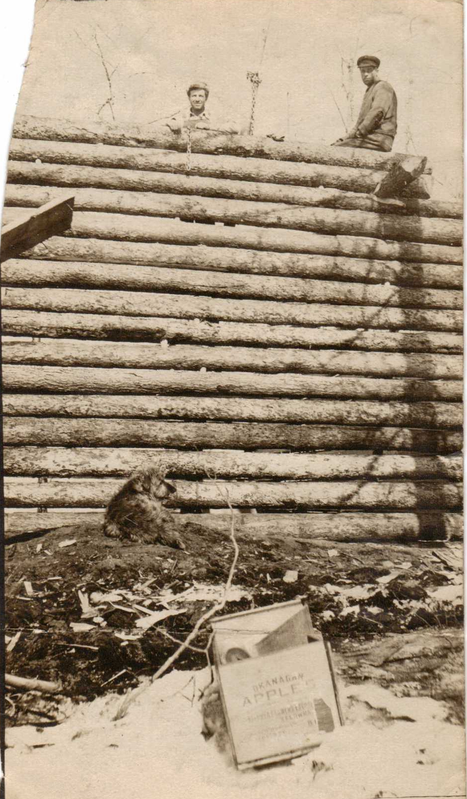
The first year the Hubert Brooks log cabbin was built right down in the valley very close to the Burnt River -
the notion being it was best to be closest to the waters edge.
This lasted less than a year, for when winter came, Hubert Brooks quickly found his
cabin buried in snow drifts. That spring, the log cabin was moved up to the top of the ridge where it remained standing for a good many years
into modern times.
A water retaining "dugout" ditch was built next to the cabin for ready water access. Hubert and Marie planted some non-native trees and flowers
that are still present on-site to this day.
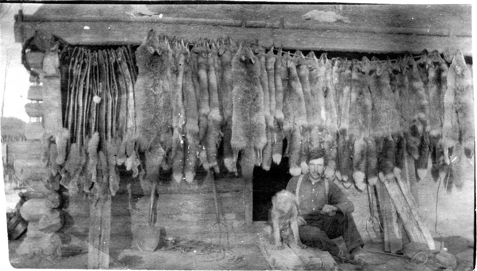
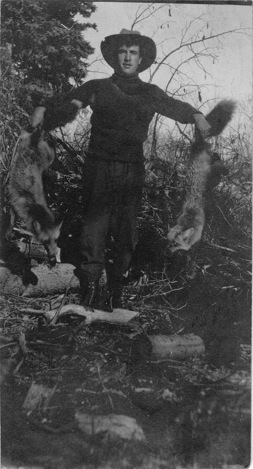
While working up their HOMESTEADS, Alfred and Aimé continued to work the fur business.
|
|
The Homestead Map of 1917 for Peace River that is shown below. The Peace River runs from left to right at bottom. The Little Burnt River runs North to South and is most visible in the 1923 Homestead map further below. Bluesky is top middle. Yellow highlites properties owned by the Brooks clan - H. (Hubert) Brooks, A.J. (Alfred Joseph) Brooks, and A.H. (Aimé Hubert) Brooks..

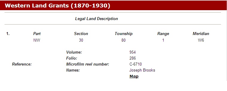
Further homestead details can be found in Libraries & Archives Canada by doing an Ancestors Search for: Hubert Brooks, or Alfred Joseph Brooks or Joseph Brooks. No land grant can be found for Aimé Brooks and it is presumed that Otto Brooks "inherited" Hubert Brooks' property following Hubert's passing and Marie's move to Saskatchewan.

|

|

|
|
Lots of options follow!!!
Click this
WEB LINK to access the site and view the official Alberta DUNVEGAN SHEET for the land grant to Hubert Brooks,
OR click this
WEB LINK to access the site and view the official Alberta DUNVEGAN SHEETS for the land grants to Hubert, Fred and Joe Brooks.
Click this
WEB LINK to access the site and view the official Alberta DUNVEGAN SHEETs for the land grant for Fred Brooks.
Click this
WEB LINK to access the site and view the official Alberta DUNVEGAN SHEET for the land grant for Joe Brooks.
So presumably to have these lands vested, Hubert, Fred and Joe would have had to have met the terms of the Dominion Lands Act -- that is, within three years of acquiring the land, cultivate at least 30 acres and had a house built on the land.
Unfortunately Alfred and Aimé's venture into furs was less than a roaring success with expenses continuing to exceed profits, so their exit from the "fur business" was not a surprise to the family.
As one relative put it:
"They had bought high and sold low!"
The families next venture was into cattle. Father Hubert Brooks agreed to buy 150 head of shorthorn cattle for his families homesteads - with Alfred and Aimé managing the herd and the cattle grazzing on their lands adjacent to the Peace River.
The abundance of wild peavine and vetch found on the banks of the Peace, when properly harvested, made a high quality feed for the Brooks' cattle.
Warren Brooks, who still retains the original cattle branding iron, remembers that the Brooks boys branded their cattle with the emblem "7M" - meant to signify the " 7 square miles of property they jointly owned".


|
To accommodate the cattle, Hubert Brooks invested in further lands as shown in the 1923 Homested map. Hubert also took the opportunity to expand his property by one quarter section to the north of his original property and to buy a quarter section across the street for son Joe.
As Tom Mastin remembers (page 532) of Where The Cold Spring Flows (Whitelaw and Surrounding Districts);
"Mr. Brooks had a homestead in the Brightside District where he kept a herd of cattle. The two eldest sons, Fred and Aime took care of the ranch.
In the late winter of 1918-19 Dad (Wm. Mastin) took a contract to make 3,000 fence posts for the Brooks Ranch. These were cut in seven
foot lengths from tamarack poles previously hauled from the " Spruce Bluff"; an area of coniferous timber some 10 miles away, which was
the prime source of building and fencing material for the area. The posts were sharpened to a point with a broad axe and were then ready for use.
He received three cents per post for this work. "
Note in reading the 1923 Homested Map for Peace River it is important to recognize the "arrows" indicate land ownership extension by the identified property owner.
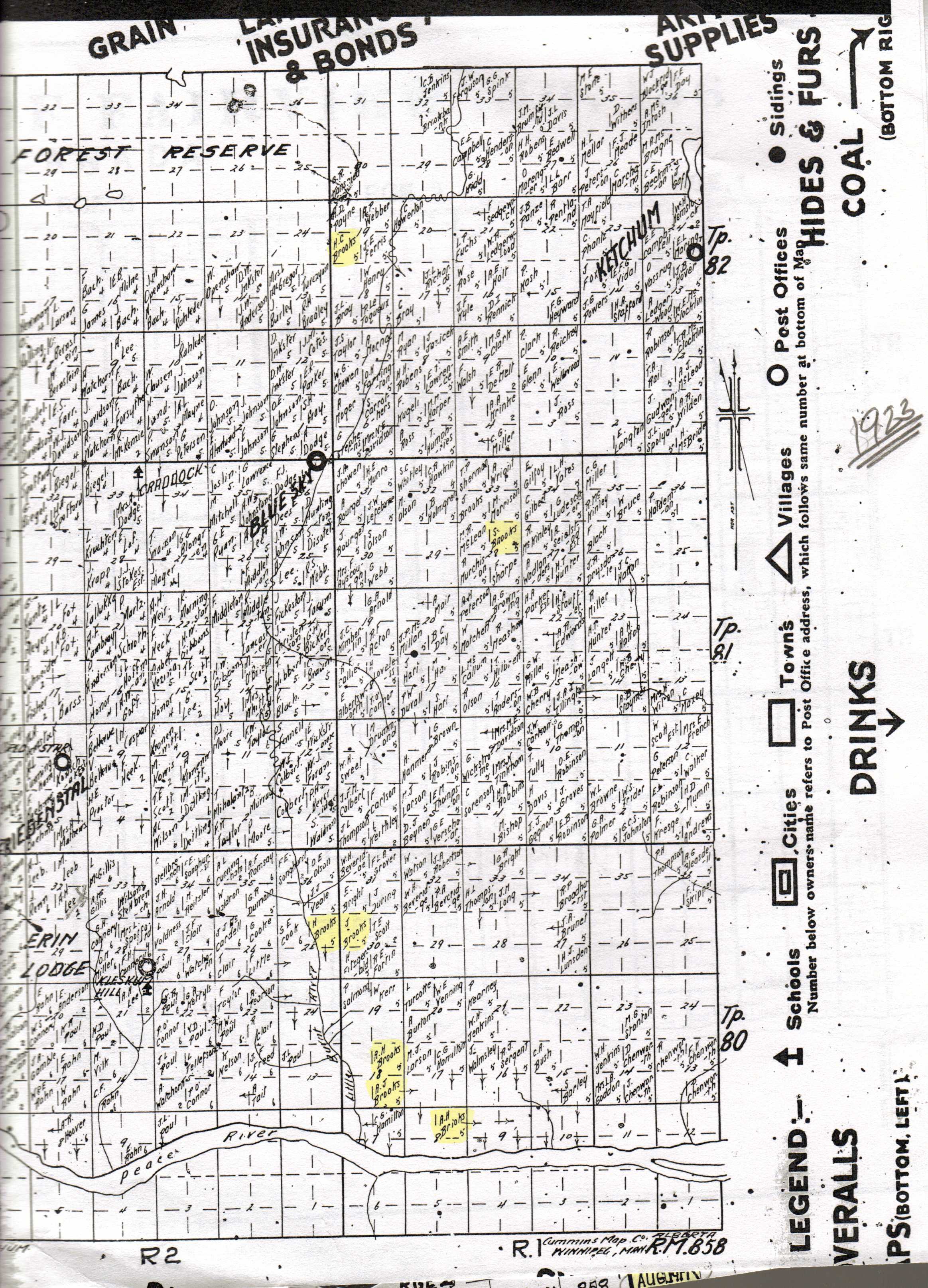
The extent of the land ownership of the Brooks clan is perhaps better illustrated by the portion of the Peace River Historical Homested Map produced by the Fairview Chamber of Commerce for their 75 th anniversary.
To orientate oneself, the Little Burnt River comes in from the north-west of the page and flows into the Peace River flowing horizontally left to right at the bottom of the map.
The bold dark lines indicate roads. For example, the 1stst vertical dark line (now Regional Road 30) comes directly down from Old Bluesky and bisects the properties of Hubert and Joe Brooks before hitting the (horizontal) (correction line) road going over to the East Burnt School. At this intersection, one would head straight south to reach Alfred and Aimé's properties along the banks of the Peace River.
The numerals on the map broadly indicate points in time when Brooks land purchases were made;
Each block on the map represents a quarter section.

|
|
|
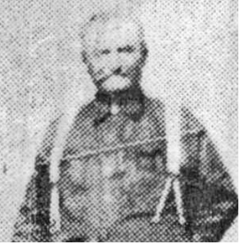
|
On July 23rd 1918 a rare extremely hard summer frost occurred that essentially wiped out the grain crops that the cattle were dependant upon for feed. All 180 of the Brooks family cattle starved to death during the fall and winter months – no straw or feed available to buy, borrow or steal!
The Brooks clan was devastated. Trying to recover something from the tragedy, Alfred and Aimé slaughtered all the cattle and then arranged transport (principally by train) of the carcuss meat to Edmonton. However their situation was not unique and there was a glut of beef on the markets with few buyers with money. The transportation costs to Edmonton exceeded the monies they obtained for the slaughtered cattle. Once again Hubert Brooks had to further dip into his savings and pay the outstanding freight costs.
Also in 1918, the ever enterprising "AJ" or "Fred" (Alfred Joseph) Brooks was elected as a Councilor on the Peace River Municipal District board – a position which he held for 1 year.
| PREVIOUS PAGE | GO TO TOP OF PAGE FOR APPENDIX NAVIGATION MENU |
NEXT PAGE |
The Life and Times of Hubert Brooks M.C. C.D.